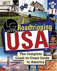
Let's
Go Roadtripping USA
The Complete Coast-to-Coast Guide to America |
|
More and more people are choosing to vacation closer to
home, and rediscovering the 'Great American Roadtrip' style
of vacation.
This book will help
you plan a small or long drive across our vast and varied
nation.
For more info, see the
two selected excerpts from the book
here
and
here. |
As a New Zealander myself, I
can say - and not be accused of parochialism - that the United
States is replete with beautiful scenery and fascinating sights.
I've driven through 35 of the 50 states, and wish I had time to
drive more of it.
While international travel is
always alluring, let's not forget all the wonders here in our
own country, and perhaps consider spending more time enjoying
the United States.
Why not go on a road-trip?
In which case, this book can be a great aid to planning your
route.
About the Book
The paperback book measures
6" x 7½" and is 1½" thick, weighing a hefty 2lbs.
A book that bills itself as
'The Complete Coast-to-Coast Guide to America' is setting itself
a fairly high standard to measure up to. At first glance,
its 1010 pages would indicate that it may indeed be impressively
comprehensive.
However, in reality, even
10,000 pages would probably be inadequate to fully cover all
of the continental US plus some of Alaska, Canada and Mexico.
Probably in recognition of
this, the book has
wisely chosen to limit itself to eight specific routes.
These routes are :
-
The Pacific Coast, 1500 miles
from San Diego to Seattle
-
The North American, 5600
miles from Mexico City to Anchorage, including 1500 in
Mexico and 2500 in Canada and Alaska
-
The East Coast, 2000 miles
from Bar Harbor, ME to Key West
-
The Southern Border, 2700
miles from San Diego to the Everglades National Park
-
The National Road, 3000 miles
from Atlantic City to San Francisco
-
Route 66, 2400 miles from
Chicago to Santa Monica
-
The Oregon Trail, 2000 miles
from Independence, MO to Oregon City
-
The Great Northern, 3800
miles from Bar Harbor to Vancouver, BC
The book is printed onto
reasonable quality white paper. It has over 160 half-toned black and white maps, but no photographs.
There is one single page of
glossy paper with color photographs in the middle of the book,
but this page contains only advertisements, and unrelated to the
book's subject.
The book was published in 2005 and
is priced at $24.99. It can be purchased online through
Amazon (of course!) as well as from most bookshops. Amazon
currently offer it with a 34% discount, at $16.49.
What the Book Contains
The largest part of the book
are the sections on each of the eight routes.
Each of the eight routes is
described in one direction from one end to the other. The
route starts off with an overview and - if applicable -
some history of the route. Some of the suggested routes
are artificial constructs created by the book's authors, and
others are based on well known routes, the most obvious of which
being Route 66.
There is a map of the entire
drive, and then sectional maps for each part of the drive.
These sectional maps are printed in a vertical format, with
north pointing in whatever direction is necessary for that
section of the route to run in a near vertical line. This
makes best use of space in the book, but can be a bit
disorienting when trying to match with one's perception of where
things are and when set alongside traditional maps with north
pointing up the page.
There are also regional maps
for areas of interest, and city maps - both area overviews of
cities and detailed maps of downtown areas. These are all
printed with the more traditional north up orientation.
City sections are subdivided
into information on Getting Around, Sights, Outdoor Activities,
Entertainment, Food, Accommodation and Nightlife. Not all
city sections have all these categories.
At the start of the book
there is a 46 page section with a wide range of related
information, including even a short history of the automobile,
and a miscellany of trivial items that are perhaps obliquely
interesting and may help you to get into a road-trip mood, even
a list of road-trip themed books and movies (but no 'Thelma and
Louise').
Some of this introductory information looks like it is included in the front
of every Let's Go guide, and some of it is dated and/or
stupid - for example, the claim that 'traveler's checks are one
of the safest and least troublesome means of carrying funds' is
rather contradicted by the immediately following section about
ATM cards. No-one needs to hassle with traveler's checks
these days.
And do we really need to be
told that hotels are commonly found in the downtowns of cities?
Note -
part of
this introductory information is excerpted here.
Road Trip Details
Each of the eight featured
itineraries provides information about the places you'll drive
through and other places reasonably close to your main driving
route.
For moderate and larger
sized towns and cities it offers a 'Vital Stats' box with
information on population size, and where to find a Visitor
Information Center, Internet Access, and Post Office.
Internet access information
typically points the reader to the local library, which while
having the benefit of being free, often suffers from never
having any free internet terminals, requiring a frustrating
wait. A dedicated roadtripper will probably head straight
to a nearby Starbucks and its Wi-Fi hotspot, with their own
laptop, and access the internet that way.
Occasional interesting
side-bar items are shown in highlight boxes.
In some cases, but not
consistently, websites are shown for features of interest, but
there are many other cases where attractions, hotels, or
restaurants have websites which aren't shown. Being as how
the book does not have complete information, and the information
it does have necessarily starts to age as soon as the book goes
to the printers, it would be prudent to add as many more urls as
possible.
One significant omission was
driving times and suggested ways to break a journey into a
number of days. While of course there is a tremendous
range of personal preference, it would have been helpful to have
seen tables saying, eg, 'if you have a week, this is how you
should plan your journey and stops' and 'if you have two weeks'
etc.
I'd also like to have seen
some loop itineraries. The eight itineraries are one way
only, so you're likely to end up driving back the way you came
for some or much of the route, or else will have to plan an
alternate return without the book's assistance.
We've published an
example of the detail contained for each route.
About Let's Go Guides
Many guidebooks are very
blandly middle class. Who among us doesn't regularly get
confused as between, eg, a Fodors and a Frommers guide - the two
seem almost interchangeable.
Others are more quirky, or
in some other way have a distinctive flavor. The Rick
Steves series, and the Lonely Planet series would be examples of
this.
Let's Go is happily more
distinctive than blandly generic, although it is becoming more
mainstream than previously. The series was founded in 1960
as a summer project by a group of Harvard students, and since
that time has continued to use students as writer/researchers.
Unfortunately (perhaps) this means that featured accommodation is more strongly
slanted to backpacker hostels than to five star deluxe resorts,
and restaurants tend to be more cafeteria and bistro style than
white tablecloth. Similarly, information on local
nightspots and the arts is more focused to the younger crowd.
If this is your style of
touring, you'll find the Let's Go guides useful. But if
this is no longer the way you travel, you might choose to hurry
on past the Let's Go guides and choose one of the more
mainstream books.
This editorial slant is of
less importance in this book than in many of the others.
For most of us, a 'roadtrip' is mainly about the driving and
sightseeing, and less about staying in deluxe hotels and
resorts; indeed, staying in some older style motels can add to
the interest and immersion in the entire traveling experience.
Information about Accommodation
and Food
The 'written by students'
nature of this book does flow through, inevitably, to a 'written
for students' feel as well.
Choosing a part of the book
at random for an example, the section on Tucson AZ lists the
first suggested sight to see as the University of Arizona.
The 'Getting Around' section tells us where the 'hip, young
crowd swings' (but omits any such information for where middle
aged or older groups congregate) and in opening its section on
Food says 'Like any good college town, Tucson brims with
inexpensive, tasty eateries', then features four places that
probably are of interest predominantly to students.
The accommodation reviews in
the Tucson section cover two hostels, a hotel with rooms from
$24/night, and an out of town resort, nothing else. There
is a separate section on camping.
In total, Tucson is given
just over four pages of text plus a full page for a city and
area map.
Tucson is one of a few
cities that lie on two different routes, and so is mentioned
twice in the book. The editors chose to duplicate the
Tucson listing rather than simply refer readers to those pages
of the other route.
Looking also at my home city
of Seattle, there are almost seven pages of text, a double page
city detail map and a 2/3rd page area map. Seventeen
restaurants are listed, being mainly low cost cafes, and none of
them offering fine dining. Two hostels and two very low
priced hotels are listed.
It is possible to debate the
writers' choices of which sights to include in this (and all
other) city profiles. Your best solution is to
buy separate guide books for specific areas that you plan to
spend some time in, and the concept of a road trip is perhaps
more focused on the traveling than on the cities and towns on
the way.
Sightseeing Information
The driving itineraries
include a random seeming amount of detail relating to the sights
you'll see and towns you'll pass through on your road trip.
For example, in OR on Hwy 101 it makes no mention of North Bend
(pop 10,000) but does have half a page on Bandon-by-the-Sea (pop
3,000). Of course, there is more to the decision to
feature a place or not than just its population; on the other
hand, it is relevant to note that a medium sized town is
completely passed over without mention.
The book also offers
occasional detours to nearby places that aren't directly on your
path. Unfortunately, these side-trips aren't always shown
on the provided maps.
It is possible to endlessly
second guess as to what is and is not included, and perhaps it
is best to simply say that more could be included.
Some of the directions, when
a route deviates off the main highway are sketchy, and
important/helpful information is sometimes missing. For
example, at almost the conclusion of the Pacific Coast drive,
readers are told merely 'take the ferry to Edmonds' without
naming the port the ferry departs from, or advising about ferry
schedules or helpful information such as avoiding travel on a
Sunday afternoon.
There is a definite
potential to get lost and/or frustrated if this book is not
supplemented by more specific driving information once you've
used the book to choose your general route.
Much that is included is
seen from the perspective of a young college student. For
example, the lovely Sol Duc Hot Springs Resort is described as
'where retirees de-wrinkle in the springs and eat in the lodge'
- a very unkind description (I'm neither very wrinkled nor,
alas, retired, and neither are many of the other guests I've met
during my frequent visits) and
this description also omits the wealth of beautiful walks through the scenic
splendor of the Olympic National Forest that surrounds the
resort.
Maps
The book has one big map in
the front, showing all eight road trips on a map of North
America. It then has one map for each road trip showing
the complete route, followed by a series of more detailed maps
splitting the route up into sections.
However, none of these maps
are drivable maps you could use to navigate from. They
have very little detail.
Area maps for some of the
featured cities, and detailed downtown maps are also provided.
The detailed downtown maps would be better than nothing, but a
'real' map would usually be preferable.
The maps suffer a bit by
being in black and white, and having only a very little
information on them. They are sufficient to enable you to
work out from where you are on these maps to where you are on a
'proper' road map, but that is about all.
Summary
This book contains a great
deal of information in its 1000+ pages, but unavoidably excludes
a great deal more information. An interesting calculation
is that each page of the book has to cover 23 miles of driving.
The book's best use may be in the
early parts of planning a roadtrip - deciding on the route you
might take, and subsequently keeping it in your car while
driving.
You'd probably also want to
do some additional research on areas of potential interest, and
to compensate for its editorial focus on student/young people's
activities/interests and low budget dining and accommodation.
While this book is not the
complete guide it describes itself as, it is a very convenient
and useful starting point for planning your own personal
American road trip.
Priced at $24.99, and
available at a generous discount from
Amazon (currently
offering a 34% discount, taking its price down to $16.49) it is
definitely good value.
|
If so, please donate to keep the website free and fund the addition of more articles like this. Any help is most appreciated - simply click below to securely send a contribution through a credit card and Paypal.
|
Originally published
15 April 2004, last update
30 May 2021
You may freely reproduce or distribute this article for noncommercial purposes as long as you give credit to me as original writer.
|